MAKE A MEME
View Large Image
| View Original: | Olomouc_map_1643_and_1644.jpg (1620x1526) | |||
| Download: | Original | Medium | Small | Thumb |
| Courtesy of: | commons.wikimedia.org | More Like This | ||
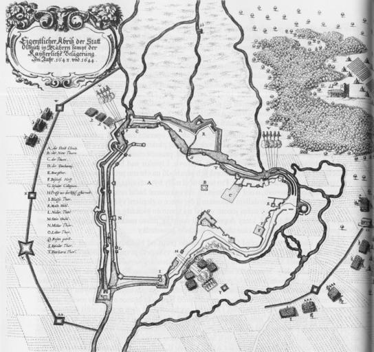
| Keywords: Olomouc map 1643 and 1644.jpg Historcal map of siege of Olomouc Czech Republic in 1643 and in 1644 From Merian Matthäus 1650 Topographia Bohemiae Moravia et Silesiae - Frankfurt am Main Obléhání města Olomouce císařskými vojsky roku 1643 a 1644 Původní zdroj From Merian Matthäus 1650 Topographia Bohemiae Moravia et Silesiae - Frankfurt am Main scanned 300 dpi from book Kuch-Breburda M Kupka V 2003 Pevnost Olomouc - FORTprint Dvůr Králové nad Labem ISBN 80-86011-21-6 ' scanned by Michal Maňas PD-old Olomouc fortress 17th-century fortress plans Maps of Olomouc 1643 1644 Old maps of cities in the Czech Republic Maps of city walls of Olomouc Location not applicable | ||||