MAKE A MEME
View Large Image
| View Original: | Old_baton_rouge.jpg (1440x1152) | |||
| Download: | Original | Medium | Small | Thumb |
| Courtesy of: | commons.wikimedia.org | More Like This | ||
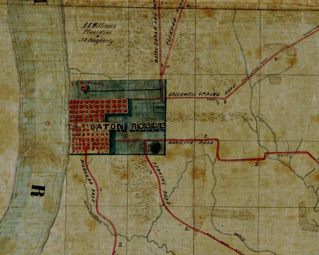
| Keywords: Old baton rouge.jpg Map of old Baton Rouge Detail from Map of the region east and north of Baton Rouge showing batteries on the Mississippi north of Port Hudson According to the Library of Congress catalog entry the creation date of the map is 1863 ; that is this date is probable but not certain Original work http //hdl loc gov/loc gmd/g4014b cw1007000 PD-USGov Old maps of Baton Rouge Old maps of Louisiana in the American Civil War Baton Rouge in the 1860s LOC-map g4014b cw1007000 | ||||