MAKE A MEME
View Large Image
| View Original: | Nunivak_1937_USCGS.PNG (774x541) | |||
| Download: | Original | Medium | Small | Thumb |
| Courtesy of: | commons.wikimedia.org | More Like This | ||
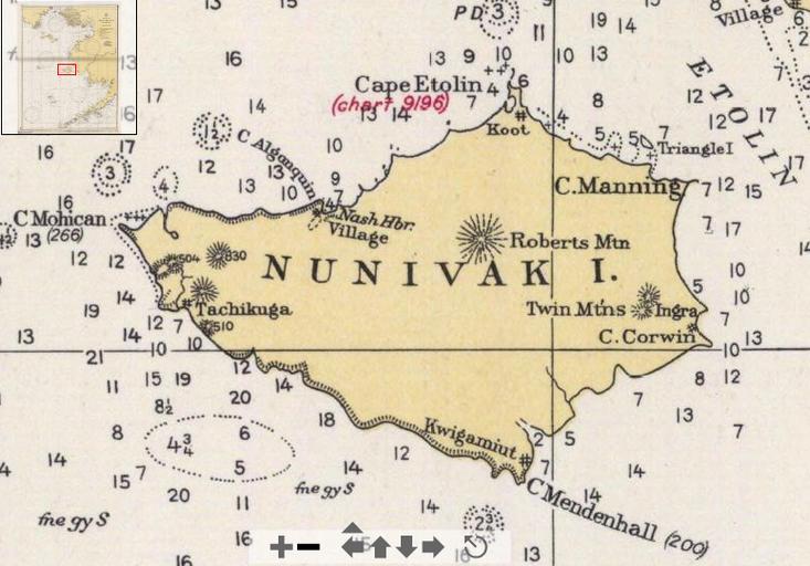
| Keywords: Nunivak 1937 USCGS.PNG en Detail of 1937 USCGS chart Bering Sea showing Nunivak Island This version shows the names and locations of the principal capes and of historic native villages Historical Maps and charts Project http //historicalcharts noaa gov/tiled_jpgs_done/zoomifyURLDrivenWebPage htm zoomifyImagePath 9302_6-1937 US Coastand Geodetic Survey 1937 PD-USGov 1937 maps Maps of Nunivak Island Old maps of Alaska | ||||