MAKE A MEME
View Large Image

| View Original: | Nunavut communites affected by Baffinland's freighters -a.png (513x498) | |||
| Download: | Original | Medium | Small | Thumb |
| Courtesy of: | commons.wikimedia.org | More Like This | ||
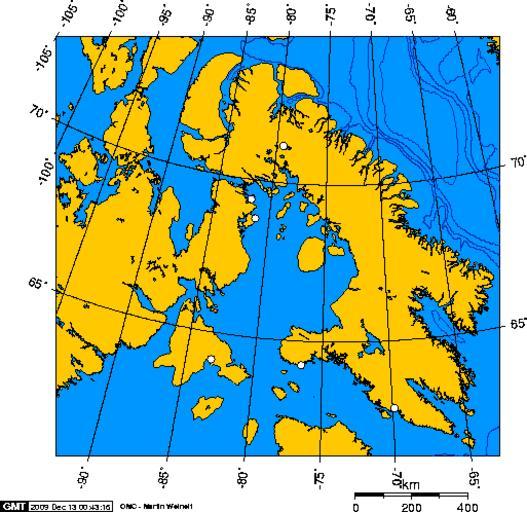
| Keywords: Nunavut communites affected by Baffinland's freighters -a.png Nunavut communites affected by the Baffinland Iron Mine's freighters Igloolik Sanirajak Salliit Kinngait and Kimmurut Self made using this http //www aquarius geomar de/omc/ online map creation tool 00 00 13 December 2009 UTC Geo Swan <span class signature-talk >talk</span> wikitable This map was self made using this http //www aquarius geomar de/omc/ online map creation tool The boundaries I used were North 74 - West -92 - East -55 - South 60 wikitable The longitude and latitude of the points plotted on this map were -79 35 71 183056 Mary River -81 799444 69 376111 Igloolik -81 224167 68 777222 Sanirajak -83 164167 64 136944 Salliit -76 540278 64 231667 Kinngait -69 868611 62 846667 Kimmurut Baffinland Iron Mine Maps of Nunavut ImageNote 1 266 132 28 19 513 498 2 Approximate location of the Baffinland Iron Mine ImageNoteEnd 1 ImageNote 2 198 342 17 17 513 498 2 Salliit ImageNoteEnd 2 ImageNote 3 237 185 16 18 513 498 2 Igloolik ImageNoteEnd 3 ImageNote 4 272 160 18 19 513 498 2 Steensby Inlet In Baffinland's original proposal this was where iron ore was to be transferred to 190 000 tonne ice-breaking freighters where a new freighter was to depart every two days In late 2014 Baffinland postponed building its railway from the oresite to Steensby inlet Instead the cheaper route to Milne Inlet will be used with the ore carried via the mine's ultra large dump trucks ImageNoteEnd 4 ImageNote 5 241 204 16 19 513 498 2 Sanirajak ImageNoteEnd 5 ImageNote 6 62 357 126 84 513 498 2 Hudson's Bay ImageNoteEnd 6 ImageNote 7 218 230 107 90 513 498 2 Foxe Basin ImageNoteEnd 7 ImageNote 8 319 39 164 101 513 498 2 Baffin Bay ImageNoteEnd 8 ImageNote 9 378 389 13 16 513 498 2 Kimmurut ImageNoteEnd 9 ImageNote 10 286 348 15 16 513 498 2 Kinngait ImageNoteEnd 10 ImageNote 11 264 398 98 45 513 498 2 Tip of the Ungava Peninsula in Nunavik the northern portion of the Province of Quebec ImageNoteEnd 11 ImageNote 12 471 34 17 33 513 498 2 This is a tiny slice of Greenland ImageNoteEnd 12 ImageNote 13 123 86 22 24 513 498 2 The tip of the w Boothia Peninsula is the northernmost extent of continental North America ImageNoteEnd 13 | ||||