MAKE A MEME
View Large Image
| View Original: | Nla.map-vn5448957 georef.jpg (3099x3156) | |||
| Download: | Original | Medium | Small | Thumb |
| Courtesy of: | commons.wikimedia.org | More Like This | ||
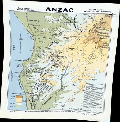
| Keywords: Nla.map-vn5448957 georef.jpg en Topographic map of Galipoli Peninsula Turkey showing ANZAC and Turkish posts trenches tracks and roads and approximate landing places Area covered from north of Bauchops Hill to Wine Glass Ridge from the Agean Sea to East of Hill Q Relief shown by contours and spot heights 1916 map face 2014 georeference National Library of Australia H E C Robinson map face Brass razoo georeference 40 236294 26 277364 Custom license marker 2014 02 15 PD-Australia Uploaded with UploadWizard Uncategorized 2014 February 15 1 | ||||