MAKE A MEME
View Large Image

| View Original: | Nizhegorodsky Terminal Moscow.jpg (687x469) | |||
| Download: | Original | Medium | Small | Thumb |
| Courtesy of: | commons.wikimedia.org | More Like This | ||
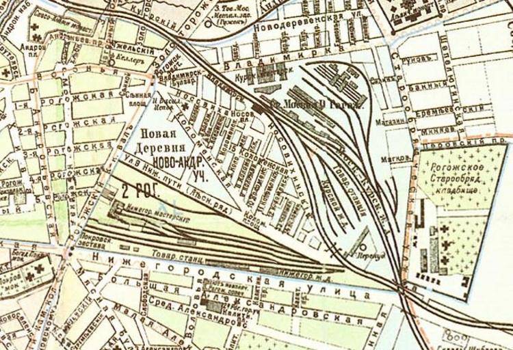
| Keywords: Nizhegorodsky Terminal Moscow.jpg en Map of the Nizhegorodsky Rail Terminal in Moscow Pre-1917 map Author before 1917 PD-RusEmpire The map is from the empire times; obvious from the old style spelling ImageNote 1 7 114 173 40 687 469 2 en Shkolnaya Street ImageNoteEnd 1 ImageNote 2 125 81 240 19 687 469 2 en Vladimirka the old road to Vladimir and Nizhny Novgorod ImageNoteEnd 2 ImageNote 3 118 270 156 73 687 469 2 Former railroad terminal serving eastward route to Nizhny Novgorod in 1861-1896 After 1896 the tracks operated as freight yard and were completely removed in 1950s ImageNoteEnd 3 ImageNote 4 542 190 127 209 687 469 2 en Rogozhskoye Cemetery ImageNoteEnd 4 ImageNote 5 495 48 35 375 687 469 2 Currently taken over by en Third Ring freeway ImageNoteEnd 5 ImageNote 6 31 8 60 48 687 469 2 en Andronikov Monastery ImageNoteEnd 6 ImageNote 7 518 3 74 38 687 469 2 Former convent of en Edinoverie worshippers demolished one small building left ImageNoteEnd 7 ImageNote 8 1 340 77 70 687 469 2 Pokrovsky Convent of mainstream Russian Orthodox Church extant and operating ImageNoteEnd 8 ImageNote 9 3 106 167 181 687 469 2 Rogozhskaya Yamskaya sloboda of coachmen serving the Vladimirka route Street grid largely survived to date but most of old buildings were replaced by highrise See category Shkolnaya Street for examples of surviving 19th century buildings ImageNoteEnd 9 Stations of Gorkovskoye direction in Moscow Stations of Kurskoye direction in Moscow Former train stations in Moscow Tagansky Nizhegorodsky Old maps of Moscow districts History of rail transport in Moscow 1863 | ||||