MAKE A MEME
View Large Image
| View Original: | New_Orleans_Lakefront_Map_1935.jpg (2358x2804) | |||
| Download: | Original | Medium | Small | Thumb |
| Courtesy of: | commons.wikimedia.org | More Like This | ||
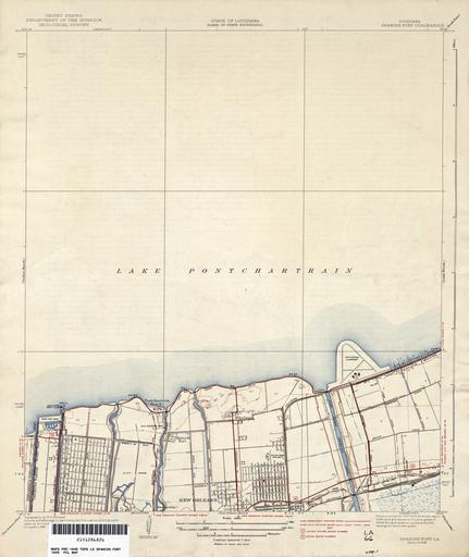
| Keywords: New Orleans Lakefront Map 1935.jpg 1935 map of portion of New Orleans showing area along Lake Pontchartrain from West End to Shushan later Lakefront Airport inclusive U S Geological Survey map 1937 via http //www lib utexas edu/maps/topo/louisiana/ 1935 surveyed 1937 published U S Geological Survey PD-USGov 1935 maps 1935 in New Orleans old maps of New Orleans Lake Pontchartrain | ||||