MAKE A MEME
View Large Image
| View Original: | New_Orleans_Jefferson_Plaquemines_Map_1954.jpg (3671x4500) | |||
| Download: | Original | Medium | Small | Thumb |
| Courtesy of: | commons.wikimedia.org | More Like This | ||
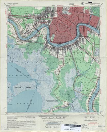
| Keywords: New Orleans Jefferson Plaquemines Map 1954.jpg 1954 map of central part of Greater New Orleans Louisiana showing much of the City of New Orleans and of Jefferson Parish and a segment of Plaquemines Parish U S Geological Survey map 1954 via http //www lib utexas edu/maps/topo/louisiana/ 1954 U S Geological Survey PD-USGov 1954 maps 1954 in New Orleans maps of New Orleans Maps of Jefferson Parish Louisiana 1954 in Louisiana Maps of Plaquemines Parish Louisiana | ||||