MAKE A MEME
View Large Image
| View Original: | Netherlands,_Ophemert,_map_of_1865.jpg (1300x1136) | |||
| Download: | Original | Medium | Small | Thumb |
| Courtesy of: | commons.wikimedia.org | More Like This | ||
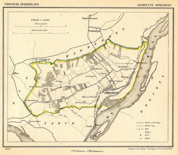
| Keywords: Netherlands, Ophemert, map of 1865.jpg nl Kaart van de voormalige gemeente Ophemert uit 1865 prov Gelderland Ophemert maakt sinds 1978 deel uit van de gemeente Neerijnen en Map of 1865 of the former municipality of Ophemert Province of Gelderland Netherlands In 1978 Ophemert became part of the municipality of Neerijnen Gemeente-atlas van Nederland naar officieele bronnen bewerkt J Kuyper 1865 Published around 1870 as part of a series of provincial atlases of the Netherlands This image is in the public domain The author J Kuyper died in 1908 In the Netherlands copyright expires 70 years after the death of the author or 70 years after first publication in the case of anonymous or pseudonymous works or works published by a legal entity Het auteursrecht in Nederland vervalt 70 jaar na de dood van de auteur of 70 jaar na de eerste openbaarmaking van het werk indien het gaat om een anoniem of om een onder pseudoniem verschenen werk of werk van een rechtspersoon The church of Ophemert is at 51 50 44 51 N 5 23 25 84 E Ophemert Gemeente Atlas van Nederland - Gelderland Maps of Neerijnen 1865 in the Netherlands Old maps of Gelderland PD-old | ||||