MAKE A MEME
View Large Image
| View Original: | NASA photo of Brooklyn and Dyker Heights.jpg (1372x1466) | |||
| Download: | Original | Medium | Small | Thumb |
| Courtesy of: | commons.wikimedia.org | More Like This | ||
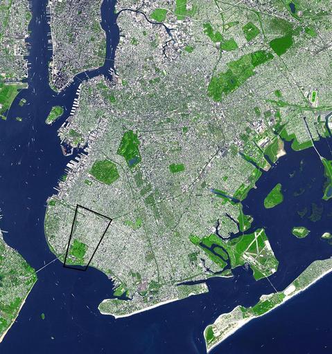
| Keywords: NASA photo of Brooklyn and Dyker Heights.jpg en wikipedia 2009 April 16 en Satellite image of Brooklyn with Dyker Heights outlined in black - south west corner of the borough This false-color satellite image shows the New York City borough of Brooklyn It was acquired on Sept 8 2002 by the Advanced Spaceborne Thermal Emission and Reflection Radiometer ASTER aboard NASA's Terra satellite Vegetated land surface is green paved urban areas are a whitish blue and water is dark blue Image courtesy NASA/GSFC/MITI/ERSDAC/JAROS and U S /Japan ASTER Science Team SOURCE http //earthobservatory nasa gov/Newsroom/NewImages/images php3 img_id 15368 en wikipedia Drilnoth CommonsHelper 2007-12-20 Cjz208 wikipedia en Cjz208 PD-NASA Original upload log page en wikipedia NASA_photo_of_Brooklyn_and_Dyker_Heights jpg 2007-12-20 04 57 Cjz208 1372×1466× 658112 bytes <nowiki> Satellite image of Brooklyn with Dyker Heights outlined in black - south west corner of the borough This false-color satellite image shows the New York City borough of Brooklyn It was acquired on Sept 8 2002 by the Advanced Spaceborne </nowiki> Aerial photographs of Brooklyn New York City Geography of New York City | ||||