MAKE A MEME
View Large Image

| View Original: | Moreton_Bay_1846_after_Baker_with_additions.jpg (2826x2015) | |||
| Download: | Original | Medium | Small | Thumb |
| Courtesy of: | commons.wikimedia.org | More Like This | ||
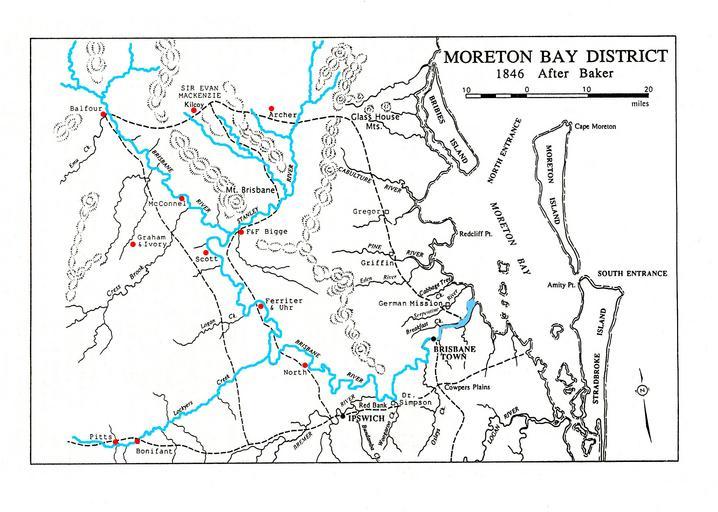
| Keywords: Moreton Bay 1846 after Baker with additions.jpg en Baker ôs map of 1846 shows the relative positions of the pioneer families of the Somerset region around the Stanley and Brisbane Rivers 2009-05-17 Baker ôs Map of Moreton Bay and part of the Darling Down Clarence Districts shewing the stations of the squatters in the Northern Districts of New South Wales 1846 Map RM1076 National Library of Australia Baker PD-old-100-1923 Uploaded with UploadWizard Maps of Queensland 1846 in Queensland Maps showing 19th-century history Maps showing history in English | ||||