MAKE A MEME
View Large Image
| View Original: | Mithapukur_in_the_Dury_Wall_Map_of_Bihar_and_Bengal,_India.jpg (387x326) | |||
| Download: | Original | Medium | Small | Thumb |
| Courtesy of: | commons.wikimedia.org | More Like This | ||
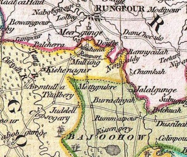
| Keywords: Mithapukur in the Dury Wall Map of Bihar and Bengal, India.jpg en This is small portion of Dury Wall Map of Bihar and Bengal India by James Rennell one of the first accurate maps of the interior of India Laid out from primary surveys done by James Rennell the first modern cartographer to map the interior of India Notes cities markets battlefields fortresses roads rivers offers political commentary and features some geographical references 1776 The Bengal Atlas Rennell James 1779 first edition http //www geographicus com/mm5/cartographers/rennell txt other versions Main image file https //commons wikimedia org/wiki/File 1776_Rennell_-_Dury_Wall_Map_of_Bihar_and_Bengal _India_-_Geographicus_-_BaharBengal-dury-1776 jpg Location 25 5417N 89 2833E PD-old-100 Uploaded with UploadWizard Old maps of Bengal James Rennell Andrew Dury 1776 maps of India Upazilas of Bangladesh | ||||