MAKE A MEME
View Large Image
| View Original: | Mitchell_Map-full.jpg (4000x2826) | |||
| Download: | Original | Medium | Small | Thumb |
| Courtesy of: | commons.wikimedia.org | More Like This | ||
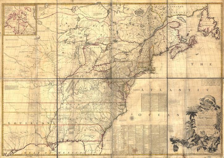
| Keywords: Mitchell Map-full.jpg Mitchell Map - A map of the British and French dominions in North America ; 1757 LOC-map g3300 ar004000 1755-1757 John Mitchell; digital version Library of Congress Geography and Map Division <gallery> File Mitchell Map-excerpt01 jpg New Hampshire Massachusetts Connecticut New York parts of Maine and Pensilvania File Mitchell Map-excerpt02 jpg The Great Lakes File Mitchell Map-excerpt03 jpg Country of the Apalachees </gallery> PD-old-100 1755 Mitchell Map | ||||