MAKE A MEME
View Large Image
| View Original: | Middlesex_Canal_(Massachusetts)_map,_1801.jpg (611x498) | |||
| Download: | Original | Medium | Small | Thumb |
| Courtesy of: | commons.wikimedia.org | More Like This | ||
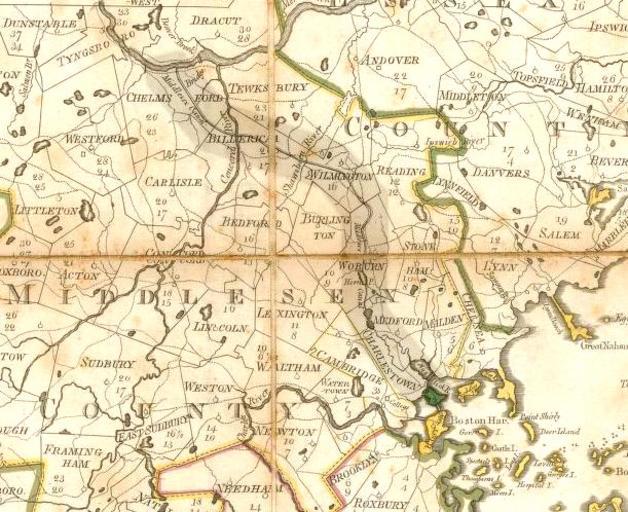
| Keywords: Middlesex Canal (Massachusetts) map, 1801.jpg Map of the Middlesex Canal Middlesex County Massachusetts 1801 This map was published about 1 year before the canal opened for boat traffic Map of Massachusetts Osgood Carleton engraved by Joseph Callendar and Samuel Hill published 1801 This scan is from the David Rumsey Map Collection and has been cropped to remove extraneous terrain and digitally enhanced to emphasize the canal's route 1801 Osgood Carleton The following text is taken from the David Rumsey web site Images copyright © 2000 by Cartography Associates Images may be reproduced or transmitted but not for commercial use For commercial use or commercial republication contact carto luna-img com This work is licensed under a Creative Commons License PD-old-100 Cc-by-2 0 Joseph Callender Samuel Hill engraver Osgood Carleton Middlesex Canal Old maps of Massachusetts | ||||
_map,_1801.jpg)