MAKE A MEME
View Large Image
| View Original: | Merwede map.png (4000x1774) | |||
| Download: | Original | Medium | Small | Thumb |
| Courtesy of: | commons.wikimedia.org | More Like This | ||
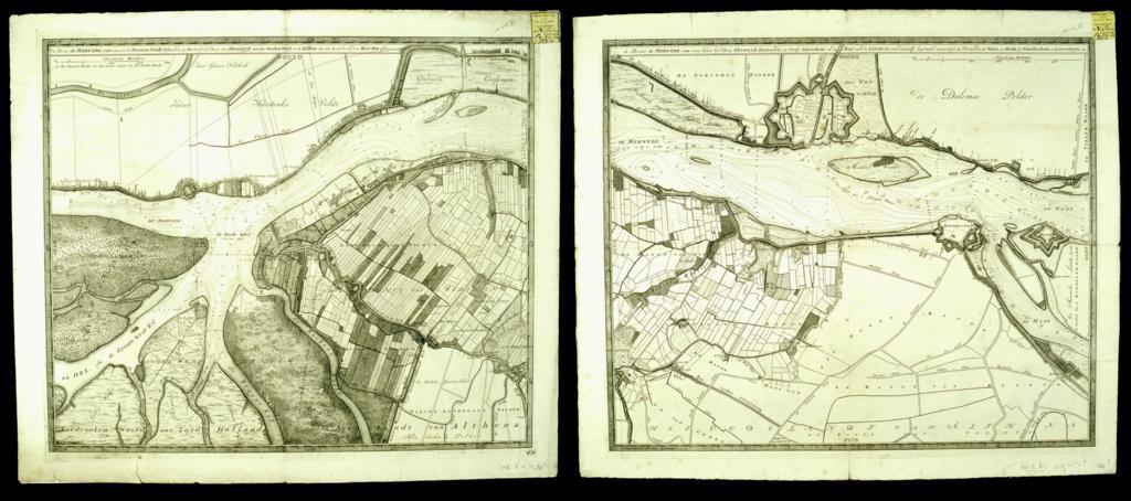
| Keywords: Merwede map.png Encyclopædia Britannica 11th ed 's Map article as the first full-scale use of isobath lines c 1730 http //objects library uu nl/reader/index php obj 1874-13243 lan en page//93/23/96/9323966217357444678300289140121243612 jpg/mode/1up De Rivier de Merwede van ontrent de Steenen-hoek Oostwaards-op tot verby het dorp van Sleeuwyk held by the University of Utrecht Nicolas Samuelson Cruquius nl Nicolaas Samuelszoon Kruik ; la Nicolaus Samuelis Cruquius other versions <gallery> File Cruquius merwede 1730 jpg </gallery> PD-Art PD-old-100 Uploaded with UploadWizard 1730 maps Maps of the Netherlands Merwede Nicolaas Samuel Crucquius | ||||