MAKE A MEME
View Large Image
| View Original: | Mendocino_Indian_Reservation.jpg (4861x6447) | |||
| Download: | Original | Medium | Small | Thumb |
| Courtesy of: | commons.wikimedia.org | More Like This | ||
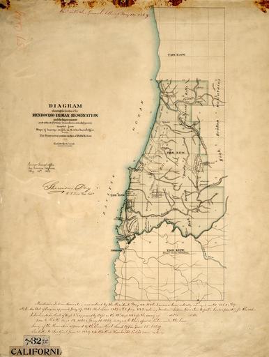
| Keywords: Mendocino Indian Reservation.jpg en This map was released in 1869 It represents a land survey of the Mendocino Indian Reservation which was in operation from 1856 through 1864 and was officially closed in 1866 The reservations headquarters and it's onsite military fort were located on what is now the town of Fort Bragg California Unlike many other reservations the ownership of this land was retained by the federal government In 1869 lands were put up for sale and sold off to the non- Indian public for 1 25 an acre 1869-05-14 national archives surveyors general office PD-USGov Uploaded with UploadWizard Old maps of California | ||||