MAKE A MEME
View Large Image
| View Original: | Melanesien (östliche Hälfte) 1870 Karte.jpg (2372x1700) | |||
| Download: | Original | Medium | Small | Thumb |
| Courtesy of: | commons.wikimedia.org | More Like This | ||
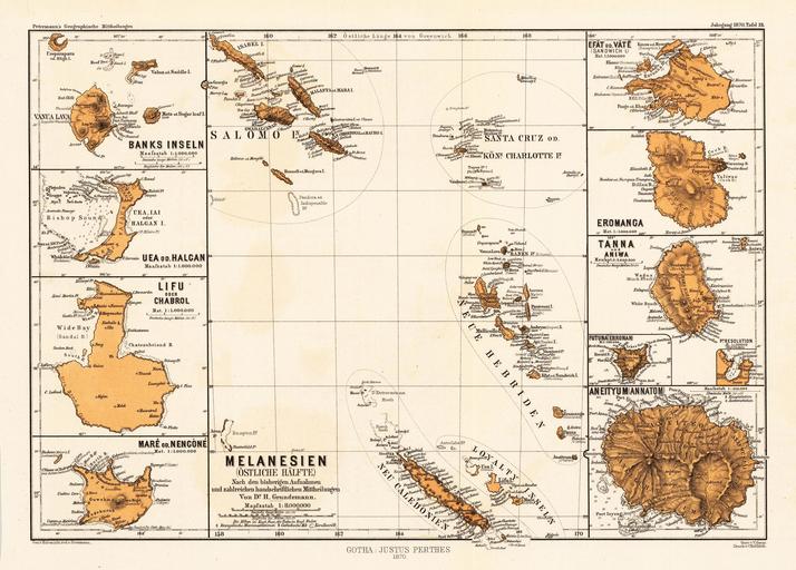
| Keywords: Melanesien (östliche Hälfte) 1870 Karte.jpg en atlas page of map insets of islands of eastern Melanesia Banks-Inseln Uea od Halcan Lifo od Chabrol Maré od Nencòné Melanesien östliche Hälfte mit Salomo Inseln Santa Cruz od Königin Charlotte Inseln Neue Hebriden Loyalty Inseln Neu Caledonien Efat od Vate Sandwich I Eromanca Tanna und Aniwa Futuna Erronan Aneityum Annatom 1870 https //www bergbook com/images/22476-01 jpg Petermann's Geographische Mitteilungen Jahrgang 1970 Tafel 19 not stated other versions PD-old-70-1923 Maps of Melanesia Banks Islands Ouvéa Lifou Maré Maps of the Solomon Islands Maps of Vanuatu Old maps of New Caledonia Éfaté Island Erromango Island Islands of Vanuatu | ||||
-1870-Karte.jpg)