MAKE A MEME
View Large Image
| View Original: | Mapa Terremoto 7,6Mw en el Sur de Chile.png (987x555) | |||
| Download: | Original | Medium | Small | Thumb |
| Courtesy of: | commons.wikimedia.org | More Like This | ||
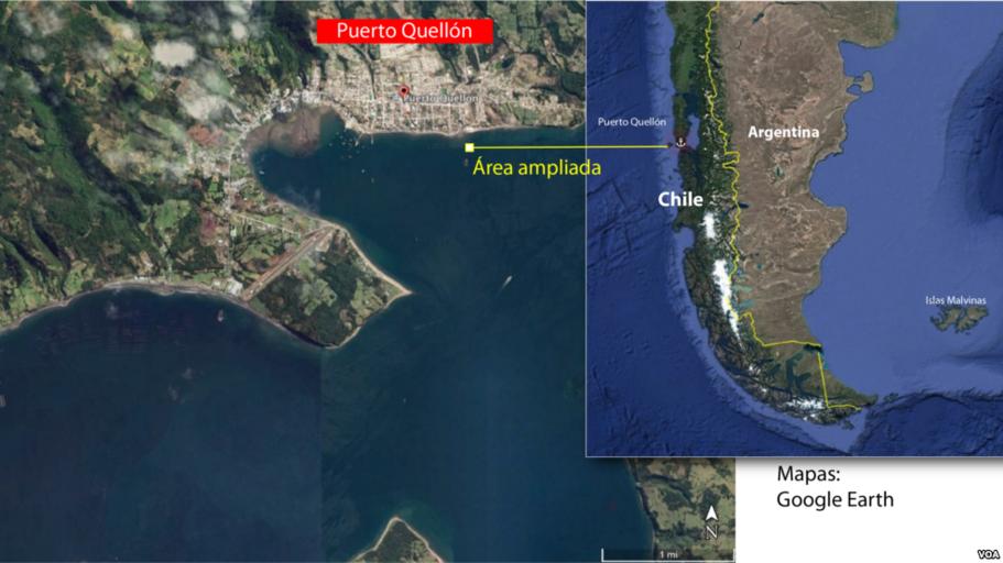
| Keywords: Mapa Terremoto 7,6Mw en el Sur de Chile.png es Mapa del terremoto que se registró el 25 de diciembre de 2016 a las 11 22 HRS hora local en la Zona Sur de Chile y que tuvo una magnitud de 7 6 grados en Map of the earthquake that occurred on December 25 2016 at 11 22 HRS local time in the Southern Zone of Chile and that had a magnitude of 7 6 grades 2016-12-25 http //www voanoticias com/a/chile-temblor-terremoto-puerto-quellon/3650186 html Voice of América / Voz de América other versions Custom license marker 2016 12 25 PD-USGov-VOA Earthquake maps | ||||