MAKE A MEME
View Large Image
| View Original: | Mapa de Francisco Morazán-Tegucigalpa(cap.).PNG (497x739) | |||
| Download: | Original | Medium | Small | Thumb |
| Courtesy of: | commons.wikimedia.org | More Like This | ||
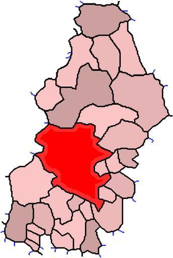
| Keywords: Mapa de Francisco Morazán-Tegucigalpa(cap.).PNG en I made this image with help of http //upload wikimedia org/wikipedia/commons/5/5d/Honduras_municipalities png this and http //upload wikimedia org/wikipedia/commons/2/2a/Honduras_departments_blank png this images Is a map of Frnacisco Morazán Tegucigalpa is in red es cree esta imagen con ayuda de http //upload wikimedia org/wikipedia/commons/5/5d/Honduras_municipalities png esta y http //upload wikimedia org/wikipedia/commons/2/2a/Honduras_departments_blank png esta imagenes Es un mapa de Frnacisco Morazán el pintado en rojo es Tegucigalpa Own KES47 martes 4 de agosto del 2009 es hecho en Paint con esfuerzo Las líneas azules son las fronteras entre los municipios y las negras entre los departamentos en made in Paint whit effort The blue lines are the frontier between the municipalitys and the black lines between the departments Francisco Morazán Department 01 Locator maps of departments of Honduras Honduras-Francisco Morazán | ||||
.PNG)