MAKE A MEME
View Large Image
| View Original: | Map_with_the_Salle_Lacaze_(blue)_on_the_Carré_Marigny_of_the_Champs-Élysées_in_Paris_1869_-_U_Chicago.jpg (867x776) | |||
| Download: | Original | Medium | Small | Thumb |
| Courtesy of: | commons.wikimedia.org | More Like This | ||
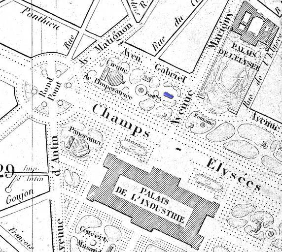
| Keywords: Map with the Salle Lacaze (blue) on the Carré Marigny of the Champs-Élysées in Paris 1869 - U Chicago.jpg Théâtre des Bouffes-Parisiens It was demolished in 1881 The title of the original map in French is Plan géométral de Paris et de ses agrandissements à l'échelle d'un millimètre pour 10 m Scale 1 10 000 See http //www lib uchicago edu/e/su/maps/paris/ Paris in the 19th Century at the University of Chicago Library website Resolution 400 dpi The light levels have been altered from those of the original digital copy a blue color indicating the location of the theatre has been added and other alterations have been made with Photoshop Elements 4 http //www lib uchicago edu/e/su/maps/paris/G5834-P3-1869-P5 html University of Chicago Digital Preservation Collection Not identified 1869 publication PD-old Salle Lacaze 1869 maps Old submaps of Paris 1869 in Paris | ||||
_on_the_Carré_Marigny_of_the_Champs-Élysées_in_Paris_1869_-_U_Chicago.jpg)