MAKE A MEME
View Large Image
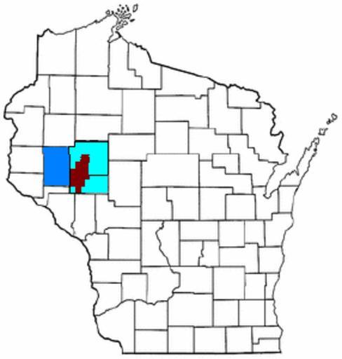
| View Original: | Map of Wisconsin highlighting ECCF Metro.png (286x300) | |||
| Download: | Original | Medium | Small | Thumb |
| Courtesy of: | commons.wikimedia.org | More Like This | ||
| Keywords: Map of Wisconsin highlighting ECCF Metro.png locator map Map of Wisconsin Areas in red are part of the Eau Claire-Chippewa Falls Metropolitan Planning Organization Areas in light blue are those portions of Eau Claire and Chippewa County not included within the MPO Adjacent Dunn County which is included also in the Eau Claire-Menomonie Consolidated Metropolitan Statistical Area is a shaded a darker blue Transferred from http //en wikipedia org en wikipedia 2007-06-10 TShilo12 at http //en wikipedia org en wikipedia based on Image Map of Wisconsin highlighting Chippewa County png Original upload log page en wikipedia Map_of_Wisconsin_highlighting_ECCF_Metro png 2007-06-10 21 53 TShilo12 286×300× 21249 bytes <nowiki>just reĂĽploading the same image with a few graphical touchups</nowiki> 2006-04-04 06 29 TShilo12 286×300× 21354 bytes <nowiki>made by me by altering Image Map of Wisconsin highlighting Chippewa County png Wisconsin </nowiki> Eau Claire Wisconsin | ||||