MAKE A MEME
View Large Image
| View Original: | Map_showing_Fort_Caroline_and_Matanzas.jpg (260x400) | |||
| Download: | Original | Medium | Small | Thumb |
| Courtesy of: | commons.wikimedia.org | More Like This | ||
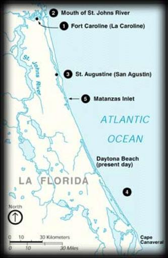
| Keywords: Map showing Fort Caroline and Matanzas.jpg en Map of the northeast coast of present-day Florida showing the locations of Fort Caroline and Matanzas Inlet 2014-03-22 15 48 41 http //www nps gov/foma/historyculture/the_massacre htm author PD-USGov Uploaded with UploadWizard Old maps of Florida Old maps of St Augustine Florida | ||||