MAKE A MEME
View Large Image
| View Original: | Map of the Roman town of Argentoratum.jpg (2816x2112) | |||
| Download: | Original | Medium | Small | Thumb |
| Courtesy of: | commons.wikimedia.org | More Like This | ||
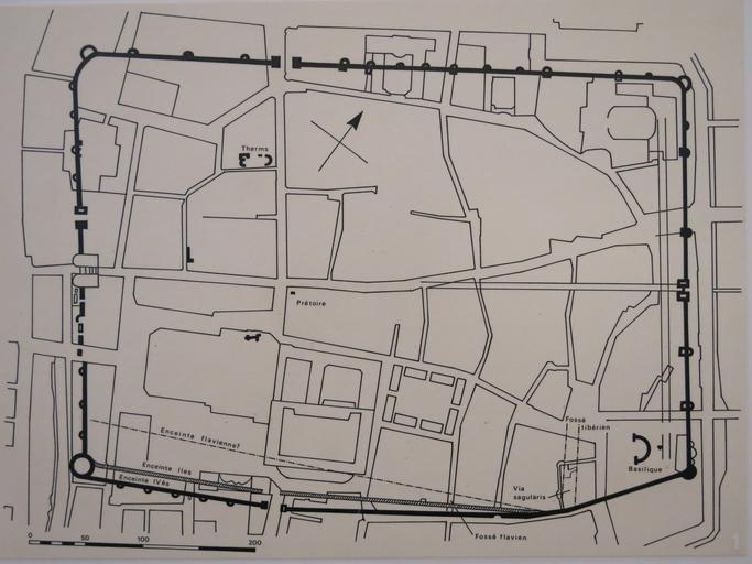
| Keywords: Map of the Roman town of Argentoratum.jpg en Map of the Roman town of Argentoratum at the 4th century after J -C in the archeological museum of Strasbourg Bas-Rhin France With the drawing of the streets of today and the place of the cathedral The North-West is at the top of the photo fr Plan de la ville romaine d'Argentoratum au 4e siècle ap J -C au Musée archéologique de Strasbourg Avec le tracé des rues actuelles et l'emplacement de la cathédrale Le nord-ouest est vers le haut de la photo sf 2014-12-12 Tangopaso 48 580954 7 747067 heading ENE Argentoratum Enceinte romaine de Strasbourg Maps of cities in France Argentoratum ImageNote 1 1007 197 88 1088 2816 2112 2 Rue du Dôme ImageNoteEnd 1 ImageNote 2 84 964 975 134 2816 2112 2 Rue des hallebardes ImageNoteEnd 2 ImageNote 3 503 1197 577 412 2816 2112 2 Cathédrale ImageNoteEnd 3 | ||||