MAKE A MEME
View Large Image
| View Original: | Map_of_Paris_1843_pari000126.jpg (2768x1596) | |||
| Download: | Original | Medium | Small | Thumb |
| Courtesy of: | commons.wikimedia.org | More Like This | ||
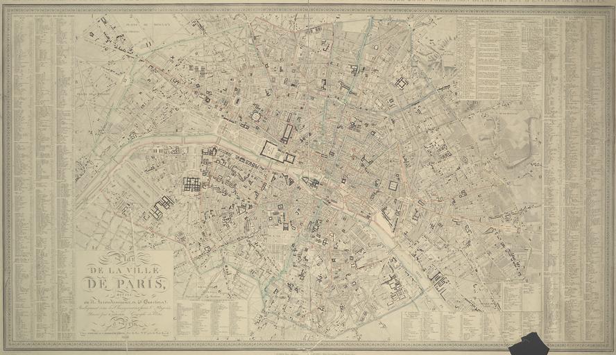
| Keywords: Map of Paris 1843 pari000126.jpg Plan de la ville de Paris divisé en 12 arrondissements en 48 quartiers indiquant tous les changemens faits et projetés jpg This 1843 plan of Paris illustrates the city's layout by arrondissement before the annexation of the Parisian communes In an attempt to improve the economic conditions of the Parisian suburbs Napoléon III presented the decree for the annexation of 11 Parisian communes on January 1 1860 The addition eventually resulted in a major increase in population 4 000 000 that demanded a geographical adjustment Paris would no longer be comprised of 12 but rather 20 arrondissements 1843 hand-colored engraved map 53 cm x 96 cm Institution Brown University Library object history exhibition history credit line John Hay Library Maps Collection Publication Paris J Goujoun et J Andriveau 1843 accession number 1115653318433625 PD-old Maps of Paris in the 19th century 1843 19th-century maps of Paris 1843 1843 in Paris | ||||