MAKE A MEME
View Large Image
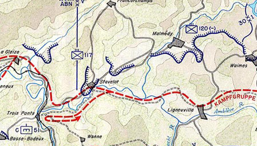
| View Original: | Map_of_Malmedy-Stavelot_December_1944.png (565x322) | |||
| Download: | Original | Medium | Small | Thumb |
| Courtesy of: | commons.wikimedia.org | More Like This | ||
| Keywords: Map of Malmedy-Stavelot December 1944.png en Map depicting the fighting between Malmedy and Trois-Ponts on 17-18 December 1944 between Kampfgruppe Peiper and elements of the US 30th Infantry Division Battle-of-bulge-northern-shoulder jpg 2010-08-31 23 35 UTC Battle-of-bulge-northern-shoulder jpg U S Army derivative work Shimgray <span class signature-talk >talk</span> PD-USGov Original upload log This image is a cropped section of File Battle-of-bulge-northern-shoulder jpg Uploaded with derivativeFX Maps of the Battle of the Bulge | ||||