MAKE A MEME
View Large Image

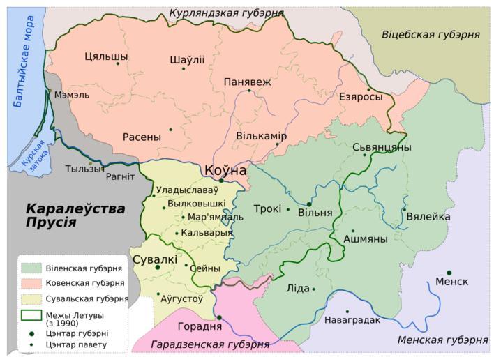
| View Original: | Map of Lietuva (1867-1914) lang-be.svg (705x510) | |||
| Download: | Original | Medium | Small | Thumb |
| Courtesy of: | commons.wikimedia.org | More Like This | ||
| Keywords: Map of Lietuva (1867-1914) lang-be.svg en Governorates of Lietuva in 1867-1914 made in InkScape original by user Knutux translated into Belarusian by user Kazimier Lachnovič 2009 PD original Image Lithuania-1867-1914 svg Knutux Maps of Lithuania under Russian and German empires 1795-1918 SVG maps in Belarusian | ||||