MAKE A MEME
View Large Image
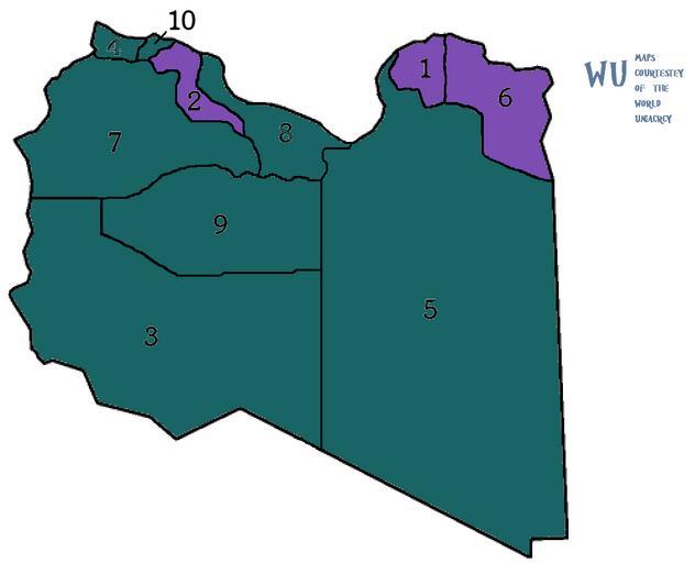
| View Original: | Map of Libya showing outlines of the ten governorates from 1963-1970.png (1000x810) | |||
| Download: | Original | Medium | Small | Thumb |
| Courtesy of: | commons.wikimedia.org | More Like This | ||
| Keywords: Map of Libya showing outlines of the ten governorates from 1963-1970.png en Map of Libya showing outlines With Election of the ten governorates from 1963-1970 Very slightly changed boundaries 1970-1983 The governorates are number alphabetically in English Libya-10-Governorates png 2011-04-21 21 12 UTC Libya-10-Governorates png Bejnar derivative work R9 <span class signature-talk >talk</span> Libya-10-Governorates png Cc-zero Original upload log This image is a derivative work of the following images File Libya-10-Governorates png licensed with Cc-zero 2011-03-22T19 24 40Z Bejnar 830x810 12934 Bytes <nowiki> en Map of Libya showing outlines of the ten governorates from 1963-1970 Very slightly changed boundaries 1970-1983 The governorates are number alphabetically in English This Map Shows A Election To Decide The New Government of Libya Turquoise Jasmine Republic Rebels Purple NTC Coalition Gray Still Gadfafii Dominated Please Help by Updating map as the situation progress Source </nowiki> Uploaded with derivativeFX Maps of the 2011 Libyan civil war | ||||