MAKE A MEME
View Large Image
| View Original: | Map from 1826 of proposed Chesapeake and Ohio Canal Route.jpg (1000x686) | |||
| Download: | Original | Medium | Small | Thumb |
| Courtesy of: | commons.wikimedia.org | More Like This | ||
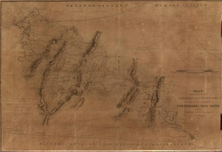
| Keywords: Map from 1826 of proposed Chesapeake and Ohio Canal Route.jpg en Scan of map dated October 1826 of proposed route of Chesapeake and Ohio Canal from Washington D C to Pittsburgh PA showing all three sections Only the eastern portion was built up to Cumberland Title says MAP of the country between WASHINGTON PITTSBURG refering to the contemplated CHESAPEAKE OHIO CANAL and its GENERAL ROUTE AND PROFILE OCTOBER 1826 Western Maryland Historical Library http //www whilbr org/itemdetail aspx idEntry 5920 dtPointer 0 Lieut Farley Wm Harrison D R Harrison 1826-10 Chesapeake Ohio Canal National Historical Park PD-old-100-1923 Scanned with Microbox Book2Net | ||||