MAKE A MEME
View Large Image
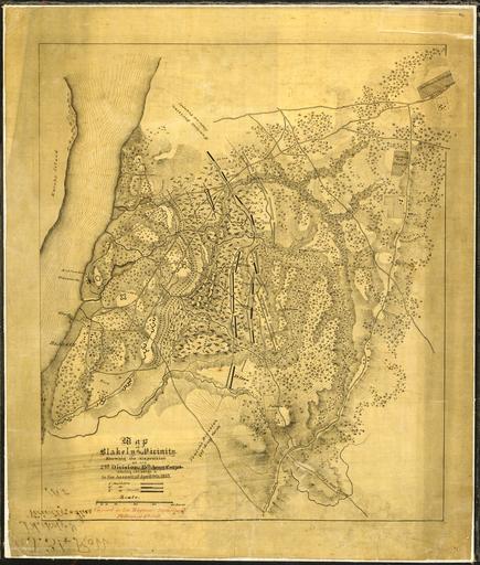
| View Original: | Map_of_Blakely_and_Vicinity._Showing_the_disposition_of_the_2nd_Division,_13th_Army_Corps,_during_the_siege_&_and..._-_NARA_-_305627.jpg (3968x4675) | |||
| Download: | Original | Medium | Small | Thumb |
| Courtesy of: | commons.wikimedia.org | More Like This | ||
| Keywords: Map of Blakely and Vicinity. Showing the disposition of the 2nd Division, 13th Army Corps, during the siege & and... - NARA - 305627.jpg Scope and content General notes 305627 Local identifier 77-CWMF-J34 War Department Office of the Chief of Engineers 1818 - 09/18/1947 Cartographic and Architectural Records Section Special Media Archives Services Division NWCS-C National Archives at College Park 8601 Adelphi Road College Park MD 20740-6001 date 1865 04 09 - 1866 02 05 Record group Record Group 77 Records of the Office of the Chief of Engineers 1789 - 1999 Record group ARC 406 Civil Works Map File compiled 1800 - 1947 Series ARC 305566 File unit File unit ARC Variant control numbers NAIL Control Number NWDNC-77-CWMF-J34 Other versions <gallery> File Map_of_Blakely_and_Vicinity _Showing_the_disposition_of_the_2nd_Division _13th_Army_Corps _during_the_siege_ amp _and _-_NARA_-_305627 tif tif File Map_of_Blakely_and_Vicinity _Showing_the_disposition_of_the_2nd_Division _13th_Army_Corps _during_the_siege_ amp _and _-_NARA_-_305627 jpg jpg </gallery> NARA-cooperation PD-USGov Battle of Fort Blakely Alabama in the American Civil War Old maps of the American Civil War | ||||