MAKE A MEME
View Large Image
| View Original: | Map of Area Occupied by Wangerriburra People, Queensland.png (1417x2079) | |||
| Download: | Original | Medium | Small | Thumb |
| Courtesy of: | commons.wikimedia.org | More Like This | ||
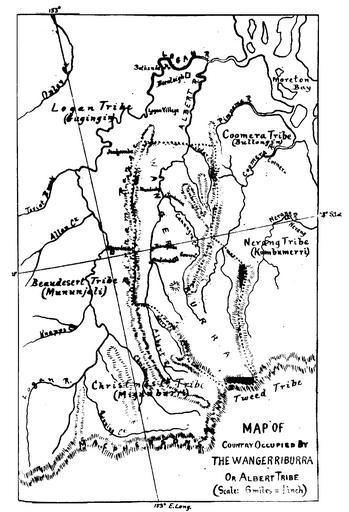
| Keywords: Map of Area Occupied by Wangerriburra People, Queensland.png en Map of area occupied by Wangerriburra people Queensland Undated before 1914 date of publication http //archive aiatsis gov au/removeprotect/63892 pdf Annual Report of the Chief Protector of Aboriginals for the year 1913 Queensland Appendix Grammar Vocabulary and Notes of the Wangerriburra Tribe Unidentified possibly from the work of John Allen Bullumm and John Lane -28 153 Custom license marker 2013 03 28 PD-Australia Uploaded with UploadWizard Maps of Queensland Mundoolun Queensland | ||||