MAKE A MEME
View Large Image
| View Original: | Map_of_the_Arctic,_1780s.jpeg (10928x9392) | |||
| Download: | Original | Medium | Small | Thumb |
| Courtesy of: | commons.wikimedia.org | More Like This | ||
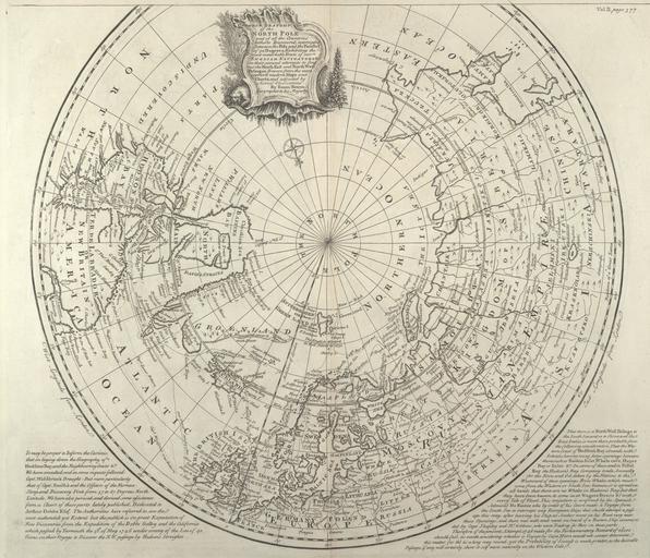
| Keywords: Map of the Arctic, 1780s.jpeg LargeImage A map of the Arctic ocean and the surrounding continents titled A correct draught of the North Pole and of all the countries hitherto discovered intercepted between the Pole and the parallel of 50 degrees http //collections mun ca/cdm4/item_viewer php CISOROOT /maps CISOPTR 98 CISOBOX 1 REC 20 Memorial University Digital Archives Institute s 1780 Creator Emanuel Bowen PD-old-100 Maps of the Arctic 1780s maps Emanuel Bowen | ||||