MAKE A MEME
View Large Image
| View Original: | Map_07-M189_Acres_of_Upland_Cotton_Harvested_as_Percent_of_Harvested_Cropland_Acreage,_U.S.,_2007..gif (740x570) | |||
| Download: | Original | Medium | Small | Thumb |
| Courtesy of: | commons.wikimedia.org | More Like This | ||
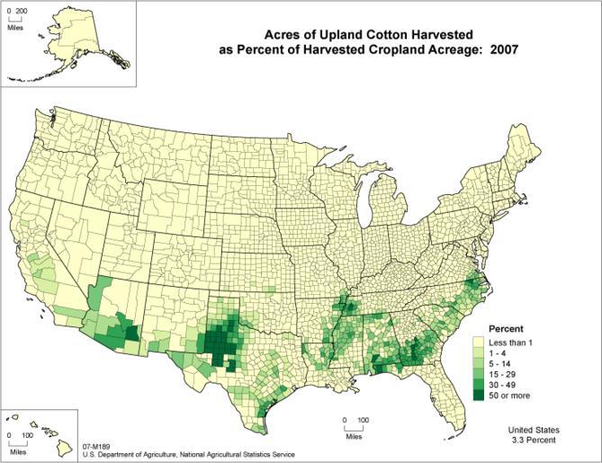
| Keywords: Map 07-M189 Acres of Upland Cotton Harvested as Percent of Harvested Cropland Acreage, U.S., 2007..gif Uploaded with en wp UW marker 2012 09 03 Census of Agriculture Map 07-M189 Acres of Upland Cotton Harvested as Percent of Harvested Cropland Acreage 2007 Choropleth map displaying acreage of upland cotton harvested as a percent of harvested cropland in 2007 There are six categories with the highest concentration in the southern states http //www agcensus usda gov/Publications/2007/Online_Highlights/Ag_Atlas_Maps/Crops_and_Plants/ National Agricultural Statistical Service United States Department of Agriculture PD-USGov United States Department of Agriculture Gossypium hirsutum Cotton industry in the United States Agricultural maps of the United States 2007 maps Choropleth maps Maps in English | ||||