MAKE A MEME
View Large Image
| View Original: | Mao_Kun_map_-_Langkawi,_Kedah,_Penang.png (656x541) | |||
| Download: | Original | Medium | Small | Thumb |
| Courtesy of: | commons.wikimedia.org | More Like This | ||
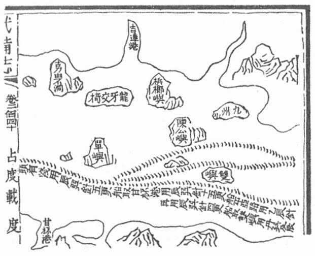
| Keywords: Mao Kun map - Langkawi, Kedah, Penang.png en Mao Kun map showing the island of Langkawi ķŠŹńēÖõ║żµżģ Kedah river estuary ÕÉēķüöµĖ» Penang island µó╣µ”öÕČ╝ and Pulau Sembilan õ╣ ÕĘ× century 17 Scanned from The Golden Khersonese by Paul Wheatley originally from Wubei Zhi a 17th century work with maps dated to Zheng He voyages Mao Yuanyi and unknown cartographer other versions PD-old-100 Uploaded with UploadWizard Mao Kun map Langkawi Maps of Penang Kedah | ||||