MAKE A MEME
View Large Image
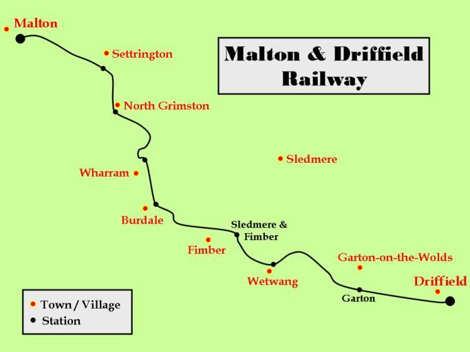
| View Original: | MaltonDriffieldRailwayRoute.png (960x720) | |||
| Download: | Original | Medium | Small | Thumb |
| Courtesy of: | commons.wikimedia.org | More Like This | ||
| Keywords: MaltonDriffieldRailwayRoute.png transport map 2007-02-25 own User MaltonMan Created by me after studying a map of the area sketching it out using a well-known presentation package and exporting the image as a png file MaltonMan en Original upload log en wikipedia ftcg page en wikipedia MaltonDriffieldRailwayRoute png wikitable - 18 43 25 February 2007 960 × 720 14 136 bytes MaltonMan w en <nowiki> Created by me after studying a map of the area sketching it out using a well-known presentation package and exporting the image as a png file </nowiki> Malton and Driffield Railway Maps of the East Riding of Yorkshire Maps of North Yorkshire | ||||