MAKE A MEME
View Large Image
| View Original: | Malheur_Reservation_map.jpg (1728x1191) | |||
| Download: | Original | Medium | Small | Thumb |
| Courtesy of: | commons.wikimedia.org | More Like This | ||
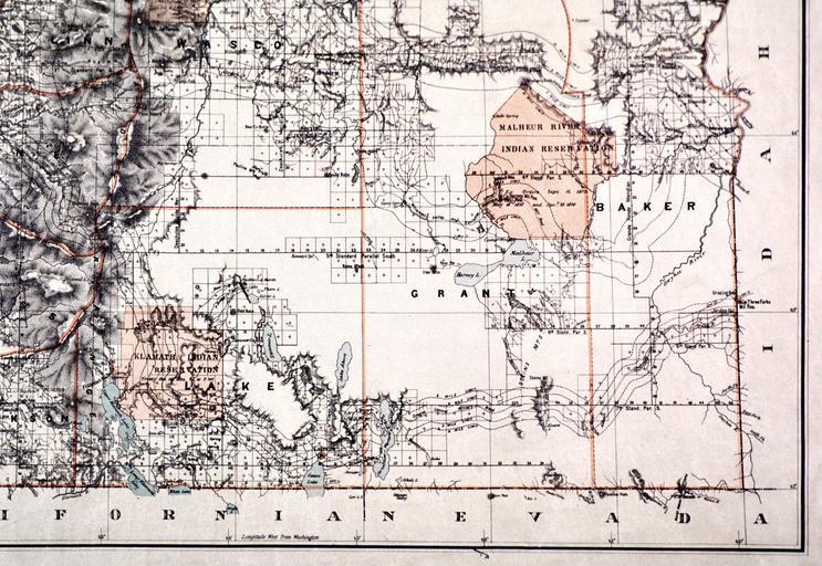
| Keywords: Malheur Reservation map.jpg en Map of the Malheur Reservation in eastern Oregon U S an Indian reservation used for seven years in the 1870s until its inhabitants were moved elsewhere http //www ohs org/education/oregonhistory/historical_records/dspDocument cfm doc_ID 63029619-9698-B33E-18180586E8AA762E C Roesser General Land Office Department of the Interior 1879 1879 maps Indian reservations in the United States Maps of Oregon PD-USGov PD-US | ||||