MAKE A MEME
View Large Image
| View Original: | Mahakam_delta_geologic_map.jpg (1048x1280) | |||
| Download: | Original | Medium | Small | Thumb |
| Courtesy of: | commons.wikimedia.org | More Like This | ||
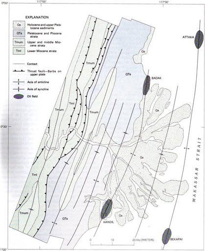
| Keywords: Mahakam delta geologic map.jpg en Geologic Map of the Mahakam Delta showing thrust faulting folding of Miocene and younger sediments and the incision of the Mahakam River into the fold belt 1979-01-01 United States Geologic Survey Professional Paper 1078 Tectonics of the Indonesian region Warren Hamilton other versions PD-USGov Uploaded with UploadWizard Geological maps of Asia | ||||