MAKE A MEME
View Large Image
| View Original: | Magyar Autonomous Region.png (619x599) | |||
| Download: | Original | Medium | Small | Thumb |
| Courtesy of: | commons.wikimedia.org | More Like This | ||
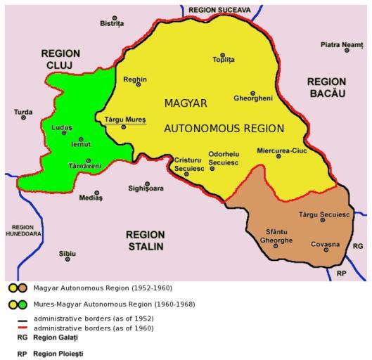
| Keywords: Magyar Autonomous Region.png en Map of the Magyar Autonomous Region 1952-1960 and Mureş-Magyar Autonomous Region 1960-1968 2013-03-27 10 31 10 http //commons wikimedia org/wiki/File Hungarian_autonomous_province02 png PANONIAN derivative work Rgvis Improved version with administrative borders changes shown during the existance of the Soviet-inspired administrative and territorial organisation 1950-1968 in Communist Romania cc-zero Uploaded with UploadWizard Magyar Autonomous Region Hungarian autonomous province03 Maps of the history of modern Romania Hungarian autonomous province03 Maps of the history of Transylvania Hungarian autonomous province03 Maps of Székely Land Hungarian autonomous province03 | ||||