MAKE A MEME
View Large Image
| View Original: | LuxembourgPartitionsMap.png (433x392) | |||
| Download: | Original | Medium | Small | Thumb |
| Courtesy of: | commons.wikimedia.org | More Like This | ||
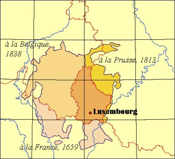
| Keywords: LuxembourgPartitionsMap.png map Map illustrating the successive partitions of Luxembourg to France Prussia and Belgium with French explanations Carte illustrant les partitions successives du Luxembourg avec la France la Prusse et la Belgique Major modifications to an originally public domain map generated by http //www aquarius geomar de/cgi-bin/map-cgi pl OMC QuartierLatin1968 2005-04-22 Duchy of Luxembourg Territorial evolution of Luxembourg Borders of Belgium-G-D Luxembourg Borders of France-G-D Luxembourg Borders of G-D Luxembourg-Germany | ||||