MAKE A MEME
View Large Image
| View Original: | Luxembourg administrative subdivisions coloured.gif (600x809) | |||
| Download: | Original | Medium | Small | Thumb |
| Courtesy of: | commons.wikimedia.org | More Like This | ||
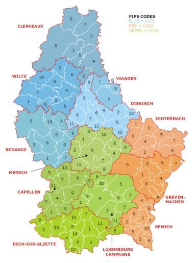
| Keywords: Luxembourg administrative subdivisions coloured.gif Map of the administrative divisions of Luxembourg Districts cantons and communes are marked and numbered according to FIPS code Own work based on w Image Luxembourg geohive gif which previously had all rights released by its original author and publisher http //www geohive com/ GeoHive Updated for the commune mergers of 2006-01-01 2006-07-21 User Bastin8 Released into public domain See licence below Maps of Luxembourg Administrative subdivisions coloured | ||||