MAKE A MEME
View Large Image
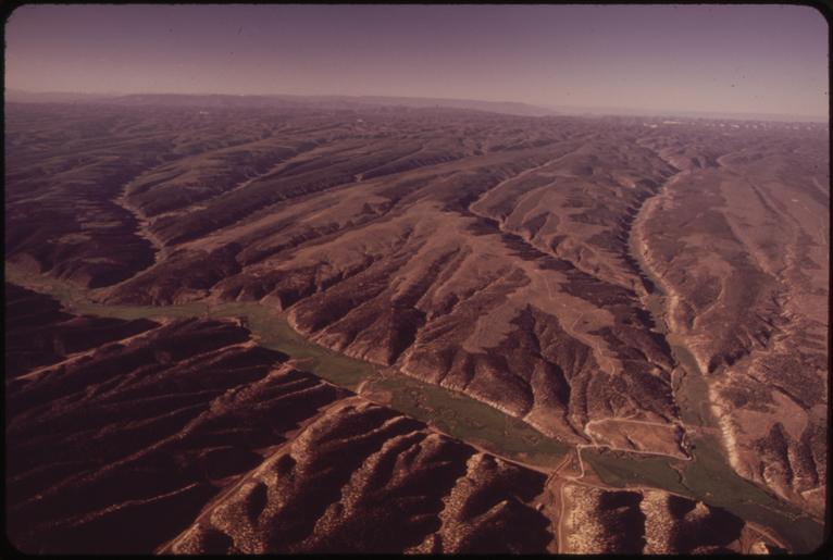
| View Original: | LOOKING_SOUTH_OVER_PICEANCE_CREEK._FEDERAL_OIL_SHALE_LEASE_SITE_"C-B"_LIES_SOUTH_OF_THE_CREEK_BETWEEN_THE_TWO..._-_NARA_-_552560.tif (3000x2018) | |||
| Download: | Original | Medium | Small | Thumb |
| Courtesy of: | commons.wikimedia.org | More Like This | ||
| Keywords: LOOKING SOUTH OVER PICEANCE CREEK. FEDERAL OIL SHALE LEASE SITE "C-B" LIES SOUTH OF THE CREEK BETWEEN THE TWO... - NARA - 552560.tif Scope and content General notes 552560 Local identifier 412-DA-10075 Environmental Protection Agency 12/02/1970 - NARA-Author Hiser David 1937- Photographer 3651517 <br /> Rifle Garfield Colorado United States North and Central America inhabited place 3315304 39 533 -107 77 <br /> Still Picture Records Section Special Media Archives Services Division NWCS-S National Archives at College Park 8601 Adelphi Road College Park MD 20740-6001 07/1973 Record group Record Group 412 Records of the Environmental Protection Agency 1944 - 2006 Record group ARC 708 DOCUMERICA The Environmental Protection Agency's Program to Photographically Document Subjects of Environmental Concern compiled 1972 - 1977 Series ARC 542493 File unit File unit ARC Variant control numbers Agency-Assigned Identifier 168/55/010075<br /> NAIL Control Number NWDNS-412-DA-10075 yes Other versions <gallery> File LOOKING_SOUTH_OVER_PICEANCE_CREEK _FEDERAL_OIL_SHALE_LEASE_SITE_ C-B _LIES_SOUTH_OF_THE_CREEK_BETWEEN_THE_TWO _-_NARA_-_552560 tif tif File LOOKING_SOUTH_OVER_PICEANCE_CREEK _FEDERAL_OIL_SHALE_LEASE_SITE_ C-B _LIES_SOUTH_OF_THE_CREEK_BETWEEN_THE_TWO _-_NARA_-_552560 jpg jpg </gallery> NARA-cooperation PD-USGov Oil shale Geology of Colorado NARA TIF images with categorized JPGs | ||||