MAKE A MEME
View Large Image
| View Original: | Londinium Augusta, Stukeley, 1766.jpg (2528x4000) | |||
| Download: | Original | Medium | Small | Thumb |
| Courtesy of: | commons.wikimedia.org | More Like This | ||
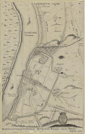
| Keywords: Londinium Augusta, Stukeley, 1766.jpg Londinium Augusta by William Stukeley published in his Itinerarium Curiosum in 1766 This map is dedicated to Count of Pembroke; his arm are depicted at bottom right The plan shows the Roman road network of London with illustrated views of the city wall and other prominent architectural and geographical features Medium Engraving 191×279mm Map scale c 5 3/4 1 Statute Mile 1 11019 British Library Shelfmark Maps Crace I number 2 British Library http //www bl uk/onlinegallery/onlineex/crace/l/007zzz000000001u00002000 html 1766 Creator William Stukeley PD-old-100 William Stukeley Old maps of London | ||||