MAKE A MEME
View Large Image
| View Original: | LocationofRichlandMill.gif (300x287) | |||
| Download: | Original | Medium | Small | Thumb |
| Courtesy of: | commons.wikimedia.org | More Like This | ||
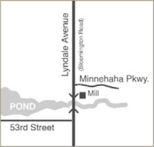
| Keywords: LocationofRichlandMill.gif Map showing location of the Richland Mill on Minnehaha Creek and Lyndale Avenue Bloomington Road in the Township of Richfield Present day in the boundaries of Minneapolis Minnesota Map illustration by Joe Hoover 2007 for book Richfield Minnesota's Oldest Suburb published by the Richfield Historical Society Reproduced with permission of the artist and released to public domain courtesy of Joe Hoover en wikipedia Innotata CommonsHelper 2009-01-02 Myotus wikipedia en Myotus Original upload log page en wikipedia LocationofRichlandMill gif 2009-01-02 06 39 Myotus 300×287× 20227 bytes <nowiki>Map showing location of the Richland Mill on Minnehaha Creek and Lyndale Avenue Bloomington Road in the Township of Richfield Present day in the boundaries of Minneapolis Minnesota Map illustration by Joe Hoover 2007 for book Richfield Minnes</nowiki> History of Minnesota Hennepin County Minnesota Richfield Minnesota Lyndale Avenue | ||||