MAKE A MEME
View Large Image
| View Original: | Lille_1922_afgeleide_small.jpg (4847x6965) | |||
| Download: | Original | Medium | Small | Thumb |
| Courtesy of: | commons.wikimedia.org | More Like This | ||
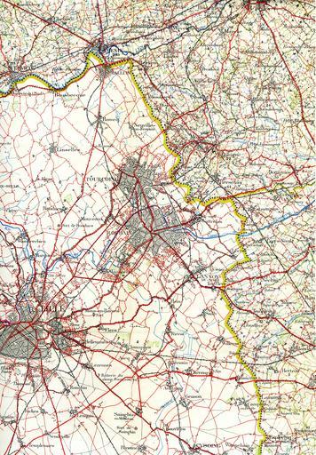
| Keywords: Lille 1922 afgeleide small.jpg en The region around Lille and the Belgian border in 1922 This shows the railways and trams around that time This military staff map was cut up and pasted on a canvas <br> Railway lines are black lines with marks on one side Smalltrack is a thinner line If there are marks on both sides it is double track nl De streek rond Rijsel met spoor- en tramwegen van 1922 Deze kaart is uitgesneden en geplakt op een canvas Lille_1922_orig jpg 2010-06-07 16 34 UTC Lille_1922_orig jpg L'Institut Cartographique Militaire Belgian army derivative work Brbbl <span class signature-talk >talk</span> removed black lines removed yellowish brbb Lille_1922_orig jpg PD-old original upload log This image is a derivative work of the following images File Lille_1922_orig jpg licensed with PD-old 2010-06-06T21 11 30Z Smiley toerist 5006x7019 7377462 Bytes <nowiki> en The region around Lille and the Belgian border in 1922 This shows the railways and trams around that time This militairy staf map was cut upp and pasted on a canvas nl De streek rond</nowiki> Uploaded with derivativeFX 1922 maps Old maps of Belgium Old maps of Lille 1922 Public transport maps of the SNCV / NMVB Rail transport maps of Belgium Local railway maps of France | ||||