MAKE A MEME
View Large Image

| View Original: | Les Principaux Systemes Geographiques des Anciens.jpg (1600x1372) | |||
| Download: | Original | Medium | Small | Thumb |
| Courtesy of: | commons.wikimedia.org | More Like This | ||
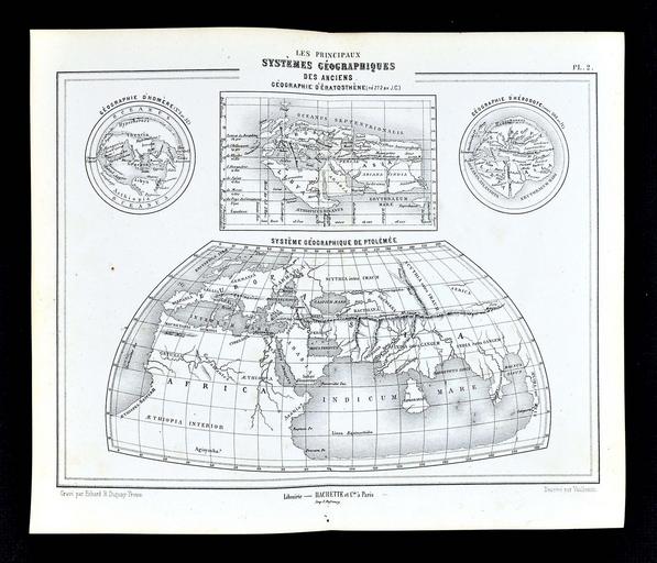
| Keywords: Les Principaux Systemes Geographiques des Anciens.jpg en The Principal Geographical Systems of the Ancients a single plate containing four inset maps depicting the world as known to Homer Eratosthenes Herodotus and Ptolemy Drawn by Vuillemin engraved by Erhard R Douguay-Trouin and printed by E Dufrenoy at Paris fr Les Principaux Systèmes Géographiques des Anciens Géographie d'Homère d'Ératosthene d'Hérodote et de Ptolémée Dessiné par Vuillemin gravé par Erhard R Duguay-Trouin imp E Dufrenoy à Paris 1877 http //www ebay com/itm/1877-Vuillemin-Map-Ancient-World-Ptolemy-Eratosthenes-Homer-Herodotus-Geography-/361706100444 hash item54375d16dc g 3v0AAOSwepJXbhI6 eBay Homer; Eratosthenes; Herodotus; Ptolemy other versions PD-old-70-1923 1877 maps Eratosthenes Maps of Homer's works Maps of Herodotus's world Maps of events told in Herodotus Maps in French Maps in Latin Ptolemy's second projection 1877 | ||||