MAKE A MEME
View Large Image
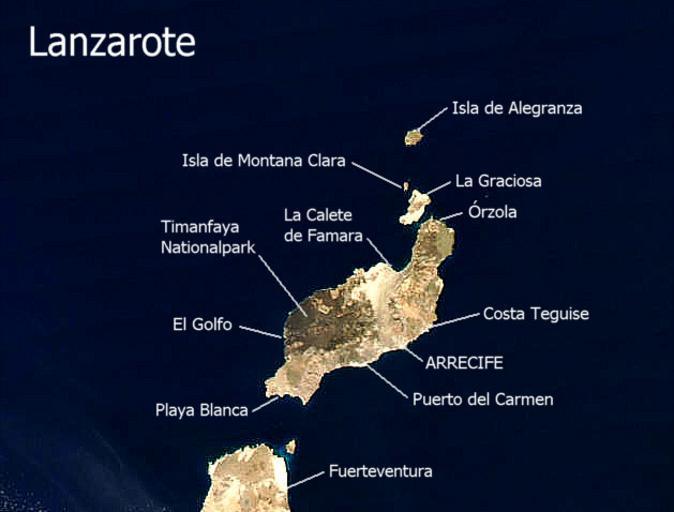
| View Original: | Lanzarote_Satellitenkarte.jpg (629x478) | |||
| Download: | Original | Medium | Small | Thumb |
| Courtesy of: | commons.wikimedia.org | More Like This | ||
| Keywords: Lanzarote Satellitenkarte.jpg Satellitenbild Lanzarote Ortsnamen selbst erstellt mit http //visibleearth nasa gov/cgi-bin/viewrecord 23074 NASA Visible Earth als Quelle für die Karte 2002-09-11 Mex wikipedia de Public Domain PD-USGov Original upload log de wikipedia Ireas CommonsHelper page de wikipedia Lanzarote jpg 2004-03-08 14 47 Mex 629×478× 59562 bytes <nowiki>Sat-Bild Lanzarote</nowiki> Satellite pictures of Lanzarote Satellite pictures of volcanoes of Spain | ||||