MAKE A MEME
View Large Image

| View Original: | Landsat7_dry_valley_lrg.jpg (6245x3640) | |||
| Download: | Original | Medium | Small | Thumb |
| Courtesy of: | commons.wikimedia.org | More Like This | ||
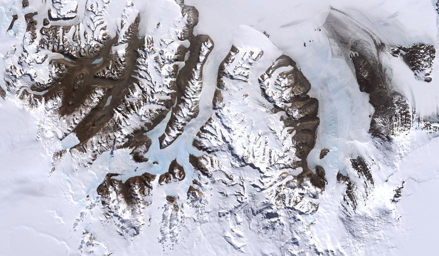
| Keywords: Landsat7 dry valley lrg.jpg McMurdo Dry Valleys Antarctica From http //visibleearth nasa gov/view_rec php id 2414 http //visibleearth nasa gov/view_rec php id 2414 Credit Image by Robert Simmon based on data provided by the NASA GSFC Oceans and Ice Branch and the Landsat 7 Science Team One of the few areas of Antarctica not covered by thousands of meters of ice the McMurdo Dry Valleys stand out in this satellite image For a few weeks each summer temperatures are warm enough to melt glacial ice creating streams that feed freshwater lakes that lie at the bottom of the valleys Beneath a cap of ice these lakes remains unfrozen year-round supporting colonies of bacteria and phytoplankton Over the past 14 years however summers have been colder than usual and the lakes are becoming more and more frozen If the trend continues the biological communities they support may go into hibernation Most of Antarctica has cooled along with the Dry Valleys in contrast to much of the rest of the Earth which has warmed over the past 100 years No one knows if the trend is related to global climate or just a quirk in the weather This image was acquired by Landsat 7 ôs Enhanced Thematic Mapper plus ETM+ instrument on December 18 1999 PD-USGov Satellite pictures of Antarctica McMurdo Dry Valleys | ||||