MAKE A MEME
View Large Image
| View Original: | Lancaster1610_-_St_Helins_Region.png (255x150) | |||
| Download: | Original | Medium | Small | Thumb |
| Courtesy of: | commons.wikimedia.org | More Like This | ||
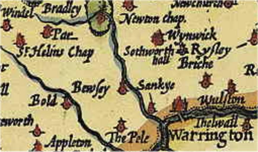
| Keywords: Lancaster1610 - St Helins Region.png en A splice of a 1610 Map showing the local region of Lancaster in 1610 own 18 04 11 June 2010 UTC Koncorde talk NIL A derivative sample of a work now in Public Domain Koncorde talk 18 04 11 June 2010 UTC PD-old-100 Original upload log en wikipedia FtCG page en wikipedia Lancaster1610_-_St_Helins_Region png wikitable Date/Time Dimensions User Comment - 19 10 14 June 2010 255 × 150 89 832 bytes Koncorde w en <nowiki> Focused on relevant area more closely to fit article ~~~~ </nowiki> - 18 04 11 June 2010 317 × 197 148 036 bytes Koncorde w en <nowiki> A splice of a 1610 Map showing the local region of Lancaster in 1610 I ~~~ created this work entirely by myself ~~~~~ ~~~ NIL A derivative </nowiki> Check categories 2015 July 4 St Helens Merseyside | ||||