MAKE A MEME
View Large Image
| View Original: | Lancashire hundreds labelled.png (826x1215) | |||
| Download: | Original | Medium | Small | Thumb |
| Courtesy of: | commons.wikimedia.org | More Like This | ||
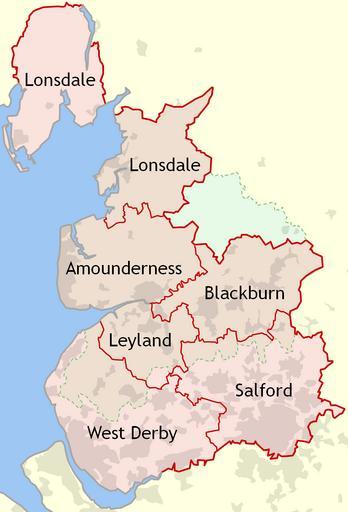
| Keywords: Lancashire hundreds labelled.png hundreds of Lancashire England The dotted green line indicates the modern-day boundary of Lancashire since 1974 own Dr Greg 2010-06-12 File Lancashire hundreds png without labels References 1929 http //www lancashire gov uk/environment/oldmap/osindex/osindex gif Combined index shewing civil parishes and the Ordnance Survey of Lancashire Ordnance Survey accessed 2010-06-12 http //www lancashire gov uk/environment/oldmap/others/hundreds jpg Lancashire County Hundreds Lancashire County Council website accessed 2010-06-12 http //mario lancashire gov uk/ MARIO Maps Related Information Online Lancashire County Council website accessed 2010-06-12 http //www ordnancesurvey co uk/oswebsite/opendata/ OS OpenData Ordnance Survey website accessed 2010-06-12 Maps of the history of Lancashire | ||||