MAKE A MEME
View Large Image
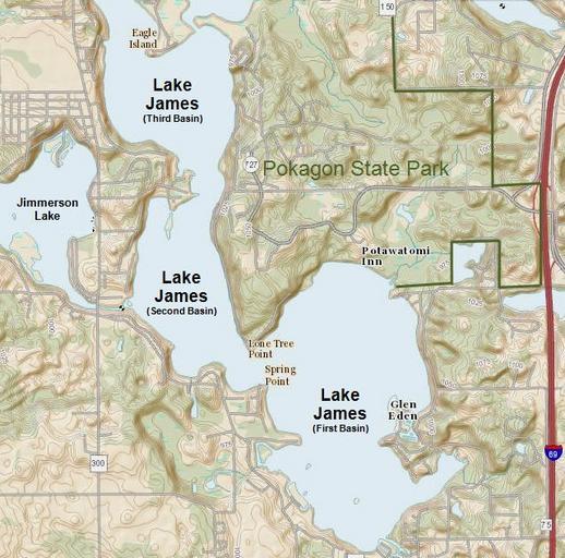
| View Original: | Lake_James,_Pokagon,_Jimmerson_map_(Indiana).png (640x632) | |||
| Download: | Original | Medium | Small | Thumb |
| Courtesy of: | commons.wikimedia.org | More Like This | ||
| Keywords: Lake James, Pokagon, Jimmerson map (Indiana).png Map of Lake James Pokagon State Park and part of Jimmerson Lake in northeastern Indiana in the United States US Geological Survey - http //viewer nationalmap gov/viewer/ p default b base1 q 41 707627 20-85 0379409 l 13 The National Map From the linked page click on coordinates for point A and zoom to the lake 2014-06-23 Conversion using Paint NET by User Finetooth from JPG to PNG of an otherwise identical map File Lake James - Pokagon State Park - Jimmerson Lake JPG created by User TwoScarsUp The base map is from The National Map from the United States Geological Survey modified by TwoScarsUp to include labels and a Pokagon State Park border PD-USGov File Lake James - Pokagon State Park - Jimmerson Lake JPG Lake James Indiana | ||||
.png)