MAKE A MEME
View Large Image

| View Original: | Kiplingsindia.jpg (802x663) | |||
| Download: | Original | Medium | Small | Thumb |
| Courtesy of: | commons.wikimedia.org | More Like This | ||
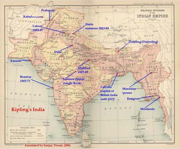
| Keywords: Kiplingsindia.jpg This is a low-resolution 40 of original scanned image of the map Politial Divisions of the Indian Empire from the Imperial Gazeteer of India volume 26 Atlas published by the Oxford University Press 1909 The map image was scanned and then annotated by me Sanjay Tiwari 18 24 30 September 2006 UTC own User Sanjay Tiwari on http //en wikipedia org en wikipedia PD-old-70 page is was here 18 24 30 September 2006 Sanjay Tiwari 880×680 126 459 bytes <span class comment > This is a low-resolution 40 of original scanned image of the map Politial Divisions of the Indian Empire from the Imperial Gazeteer of India volume 26 Atlas published by the Oxford University Press 1909 The map image was scanned and the </span> Uploaded using http //tools wikimedia de/~magnus/commonshelper php CommonsHelper or http //tools wikimedia de/~magnus/pushforcommons php PushForCommons PD-old Check categories 2009 November 2 ca wikipedia Rudyard_Kipling Rudyard Kipling 2 Files by User Sanjay Tiwari from en wikipedia Rudyard Kipling Maps of literature Original upload log page en wikipedia Kiplingsindia jpg 2007-05-14 07 25 Kintetsubuffalo 802×663× 117058 bytes trimmed to make edges equal 2006-09-30 18 24 Sanjay Tiwari 880×680× 126459 bytes This is a low-resolution 40 of original scanned image of the map Politial Divisions of the Indian Empire from the Imperial Gazeteer of India volume 26 Atlas published by the Oxford University Press 1909 The map image was scanned and the | ||||